
So yesterday I went on a 12-hour road trip with my Mom to the village of Volcano. It takes around two and a half hours to get there from my house so I had a checklist of questions I needed to have answered before I left. It was a blast just hanging with and chatting with my Mom all day. I obviously need to do a lot more of that.
Anyways… The checklist was to discover all the unknown details I needed to complete a successful Sea to Summit of Mauna Loa and Kilauea Volcanoes all in one run.
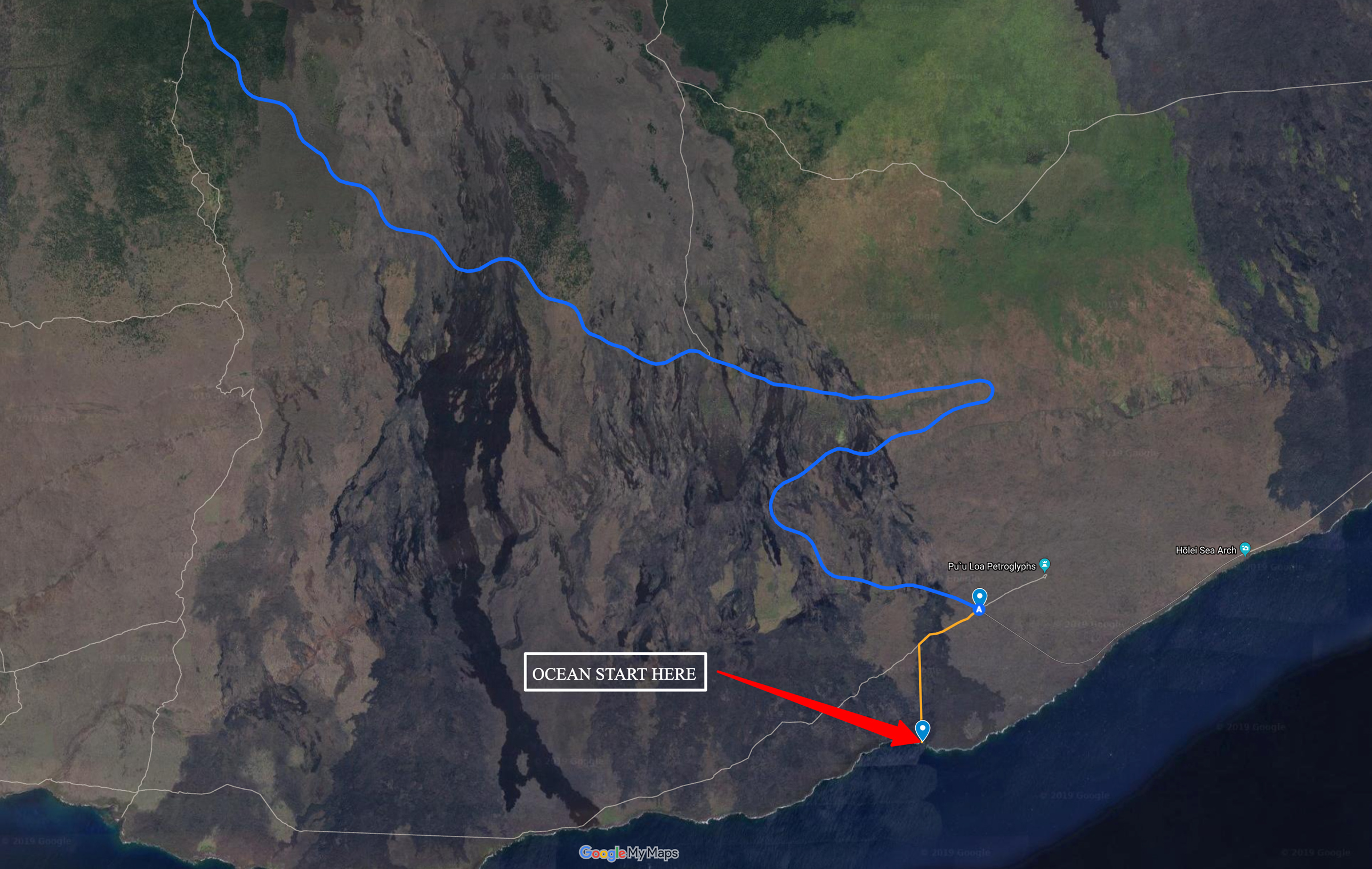
Where is a true water start from the bottom of Chain of Craters Road (CoC)?
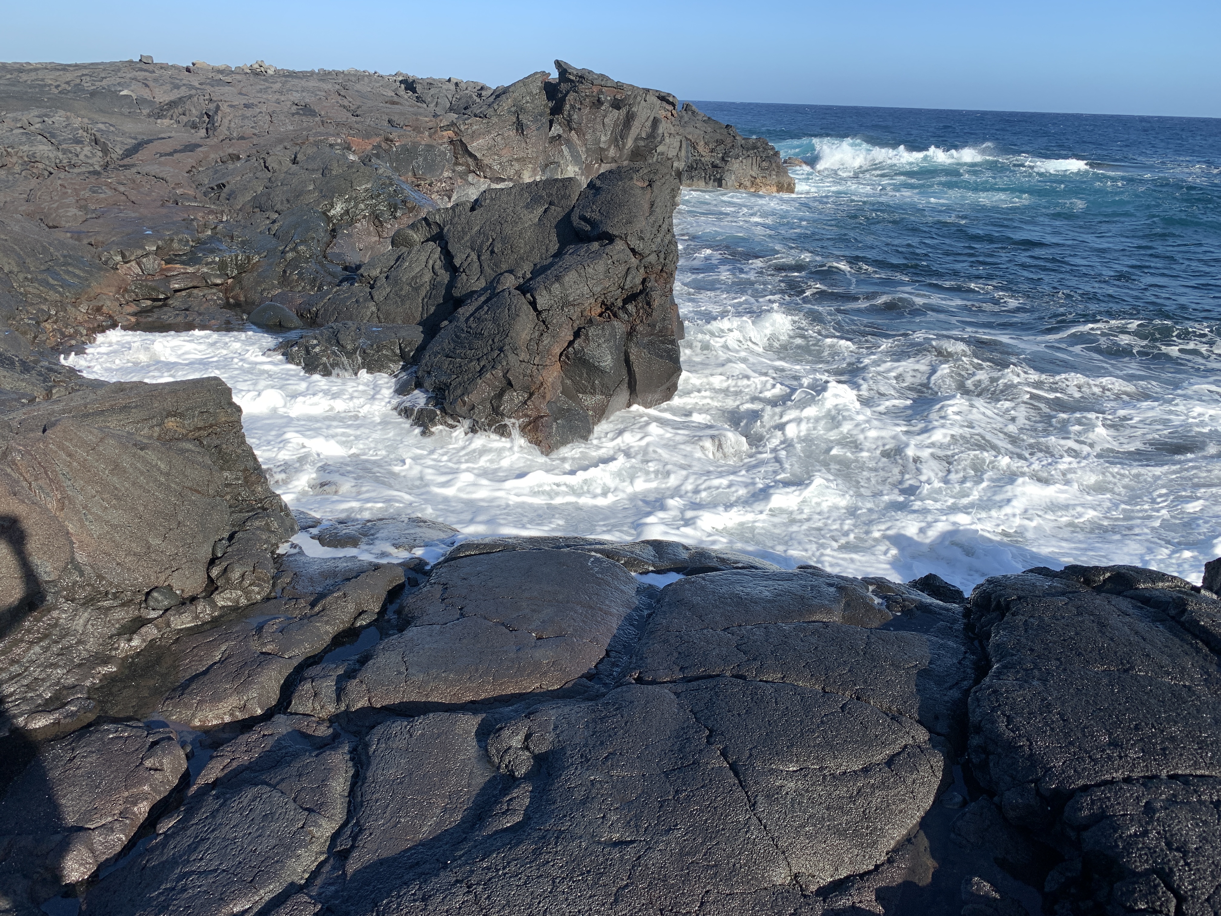
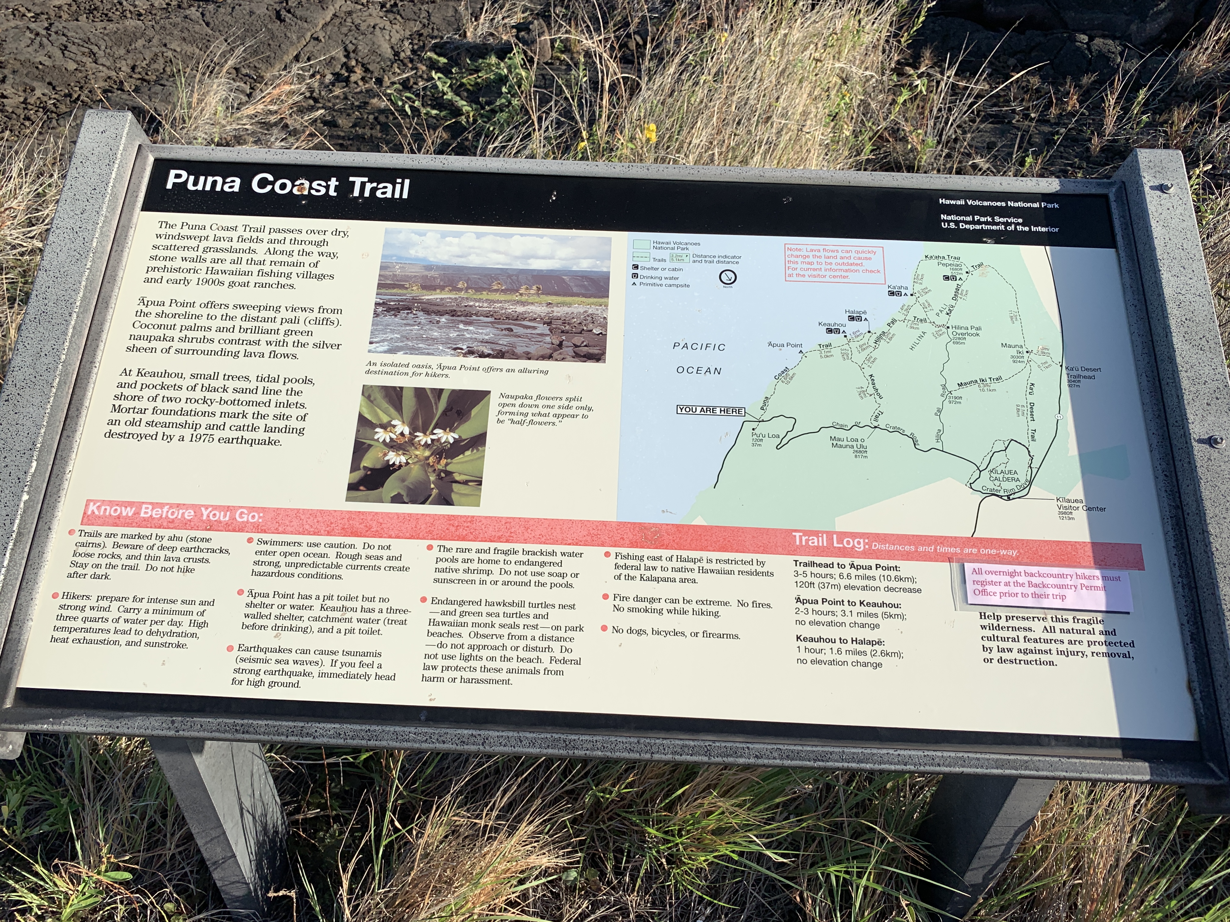
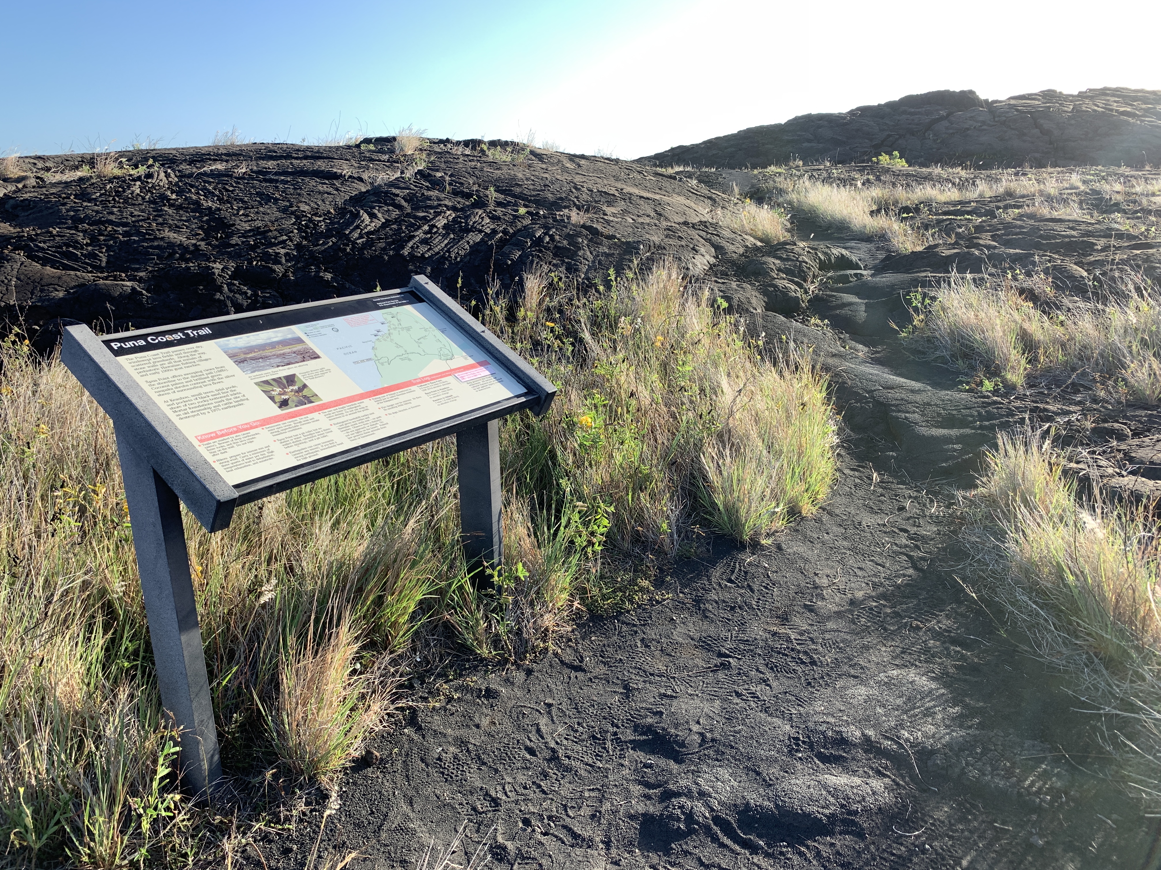
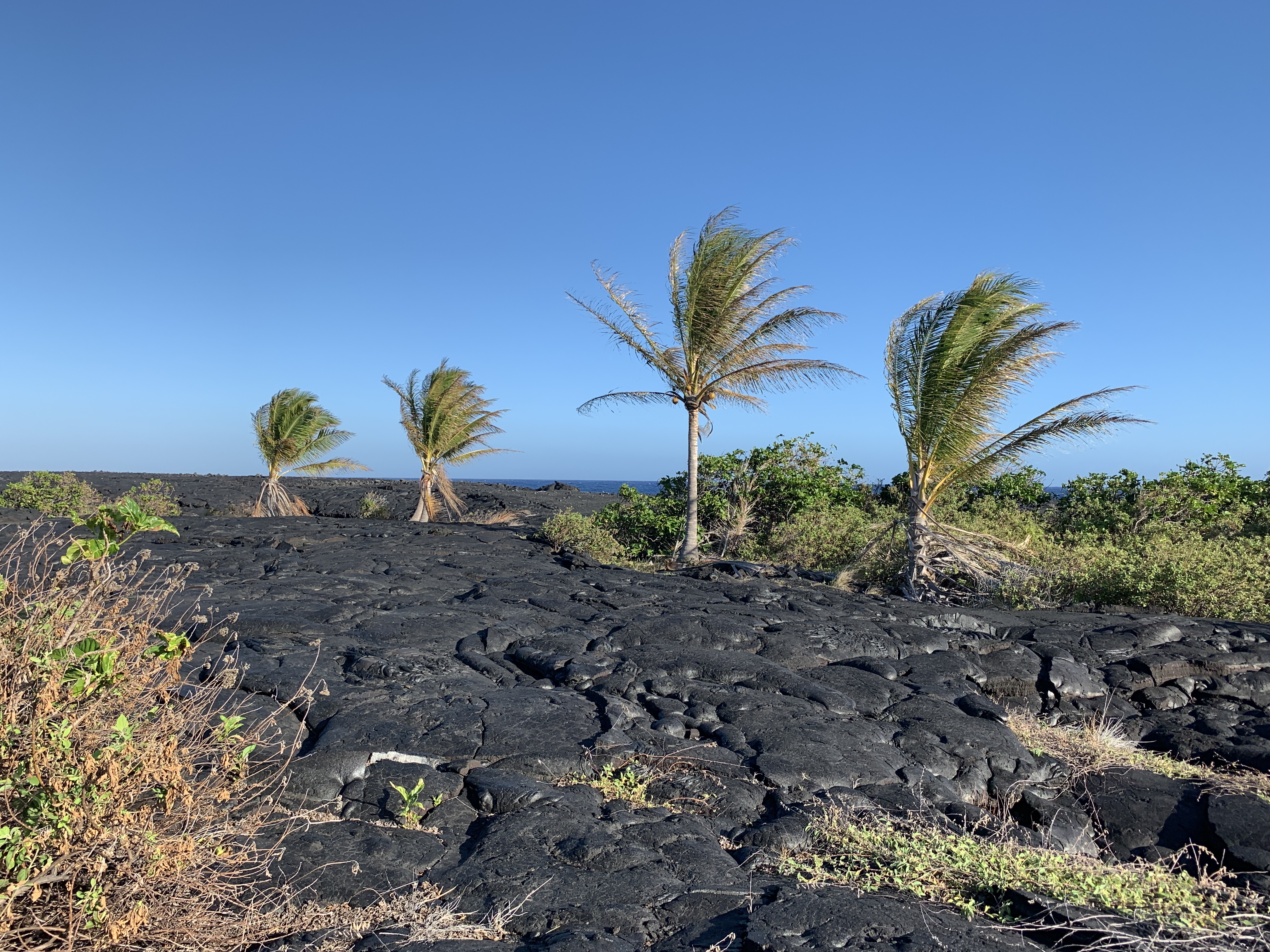
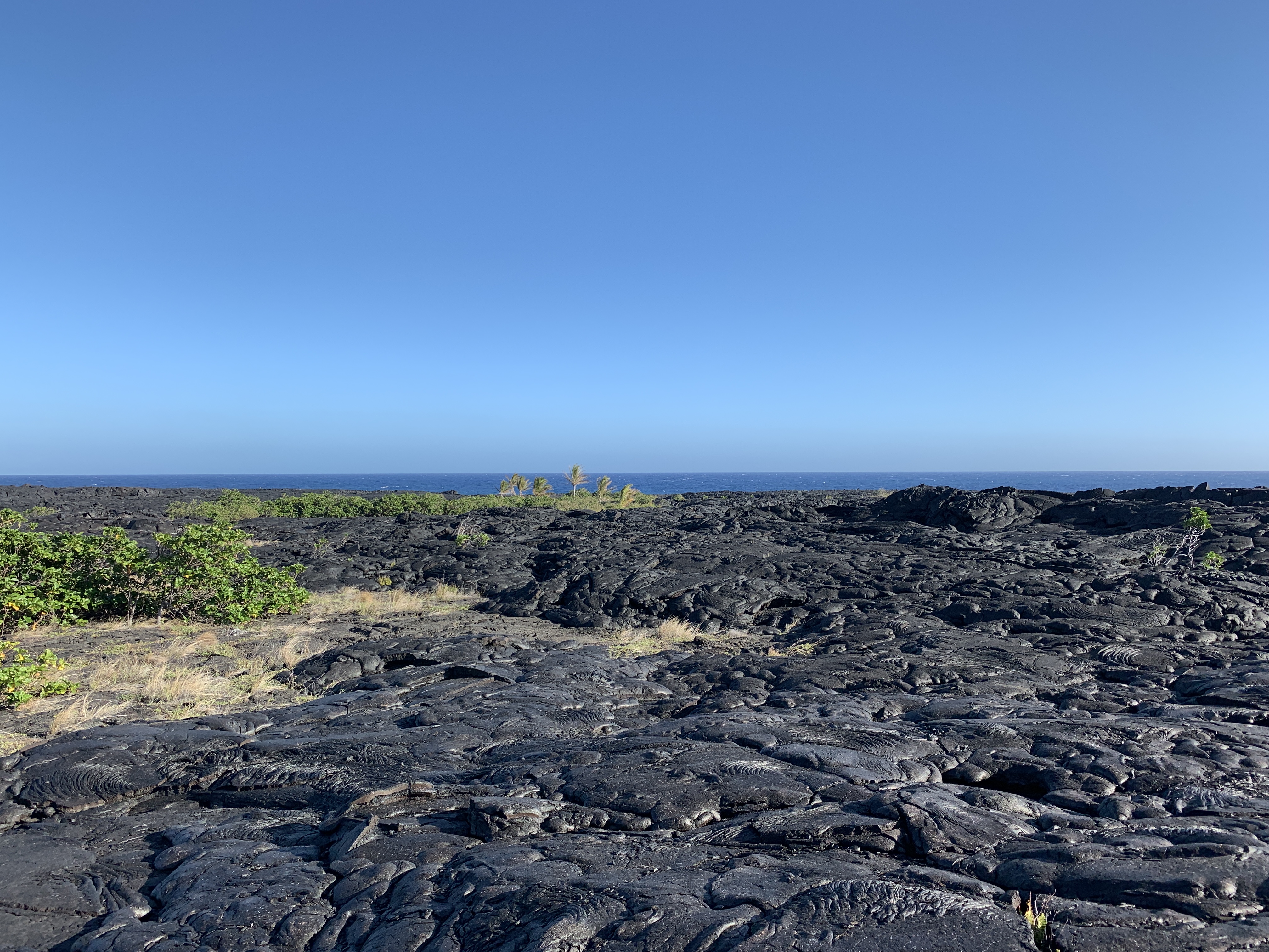
Anyone who has been to the bottom of the Chain of Craters road knows that basically, you are at the edge of big cliffs that drop into the sea. And there is no smooth way to go and touch the water for an ocean start. From staring at Google Satellite images for quite some time I found what I thought was a very low point a mile or so west of the bottom of the CoC road. So we drove down there to check it all out and sure enough 1.4 miles from the Puna Coast Trail parking pullout I found the perfect little spot I could touch and collect the ocean offering(s) for the summit(s). And it was just this beautiful and isolated little spot with 4 little palm trees trying to get a foothold into the lava. Entertainingly the trail and the subsequent detour down to the “Beach” was just like traveling anywhere near the Mauna Loa summit. Just miles of Pahoehoe and A’a flows with cairns (rockpile markers) to guide you through the terrain. But this section had little bits of life trying to grow in it and you get nice thick oxygen-rich air – haaa.
Where can I stash water, food, and clothing to support the first 34 miles of this run?
It seems if I want just 1 stash the logical spot is near the Kilauea Military Camp (KMC). Even though it is approximately 21 to 23 miles in, it offers a logical transition area for getting the things I need. It also is a logical finishing point for running Kilauea to its summit. I’ll be starting early like 3-4 am so I can get through most of the lower miles without the heat or the traffic. The CoC road has almost no shoulder and I prefer to run against traffic to see what is coming towards me. And in the cooler temperature, I can go farther with less water.
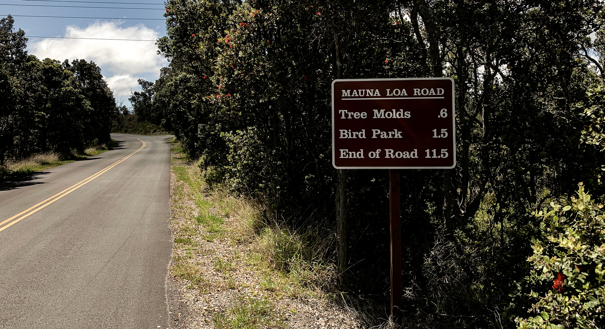
How is the Mauna Loa Road up to the Mauna Loa Lookout?
Well, the Mauna Loa Road (also known as the Mauna Loa Strip Road) is around 11.5 miles long and goes from 4,000 to 6,700 feet. But it has a ½ mile or so of downhill which was a big surprise since I really don’t remember that detail. And that got me thinking when you really look at the contours of this area on a topographical map – where is the real summit of Kilauea (I discuss that more below)? The road turns into a 1 lane road within a couple of miles and then meanders nicely up the hill. It really will be a beautiful section to run up with spectacular views and secluded tree canopied sections. It’s been pretty dry up there so it isn’t quite as lush as it can be. But still beautiful. At the lookout the trail is obvious and the area is shaded so nicely it will make a great staging area to transition into backcountry gear and get ready for the really hard part of the run.
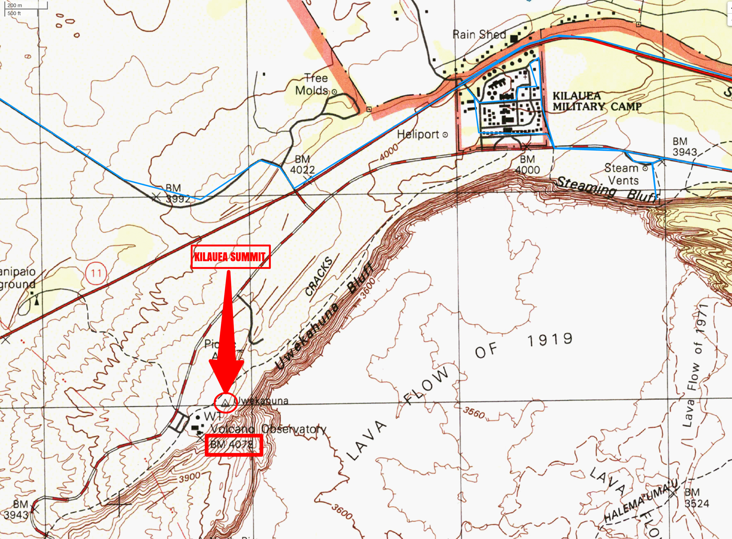
Where is the “True” summit of Kilauea?
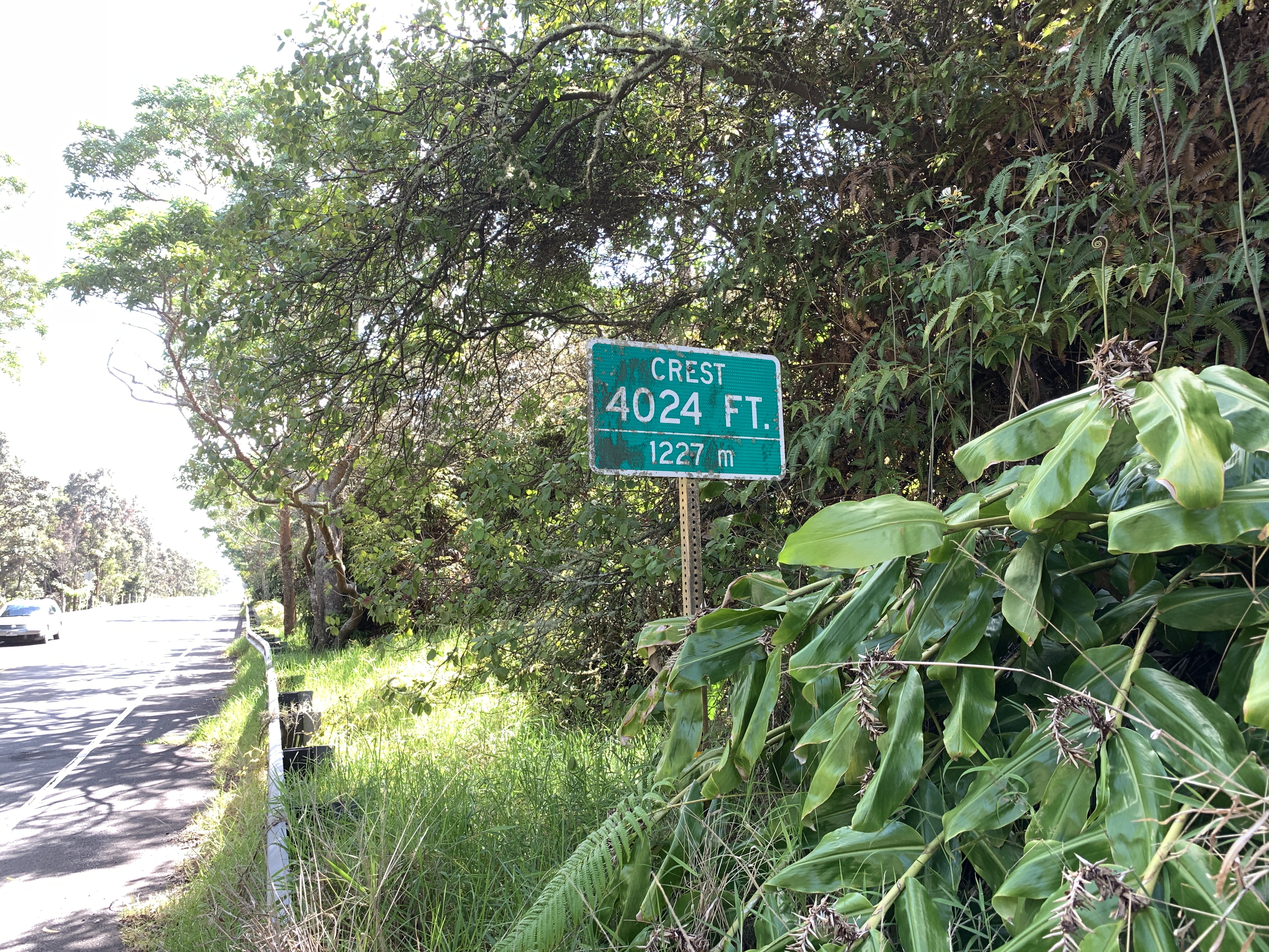
I’ll start off by saying here that if anyone knows different please let me know. I asked everyone from locals to Park Rangers and most had no idea (or even cared) where the summit is. But I got the best information from a couple of people who have lived in Volcano for years and know their volcanoes so I am apt to trust their word on the topic. Apparently along the Mamalahoa Highway right after Pi’i Mauna Rd and a half mile before the Nation Park entrance are signs on both sides of the road (pictured below) that merely say: CREST 4024 FT. / 1227m. I know – so uncelebrated and anticlimactic I had to laugh. But it does seem to have a valid shot at being the summit. Now on Wikipedia (and a few other sources online), the summit is claimed to be 4088 feet. And if you deep dive you find the NGS Data Sheet for Kilauea which states the highest point is 4088 feet and states to get there:
STATION RECOVERY (1977)
TO REACH THE STATION FROM THE NATIONAL VOLCANO OBSERVATORY, GO NORTH ON A TRACK ROAD FOR 0.15 MILE (0.24 KM) TO THE STATION ON THE RIGHT NEAR THE RIM OF THE CRATER. STATION MARK, STAMPED 4088 1912, IS A USGS BENCH MARK DISK CEMENTED IN A DRILL HOLE IN A BOULDER WHICH IS FLUSH WITH THE GROUND SURFACE. A 5- BY 5-FOOT STONE AND CONCRETE PLATFORM ABOUT 3.5 FEET (1.1 M) HIGH IS OVER THE STATION.  IT IS ABOUT 200 YARDS NORTH OF THE OBSERVATORY AND 15 FEET (4.6 M) WEST OF THE WEST RIM OF THE CRATER.

STATION RECOVERY (2011)
RECOVERY NOTE BY GEOCACHING 2011 (KAL) LOCATED SOUTH OF THE ASPHALT RIM TRAIL INSIDE THE STONE AND CONCRETE STRUCTURE.
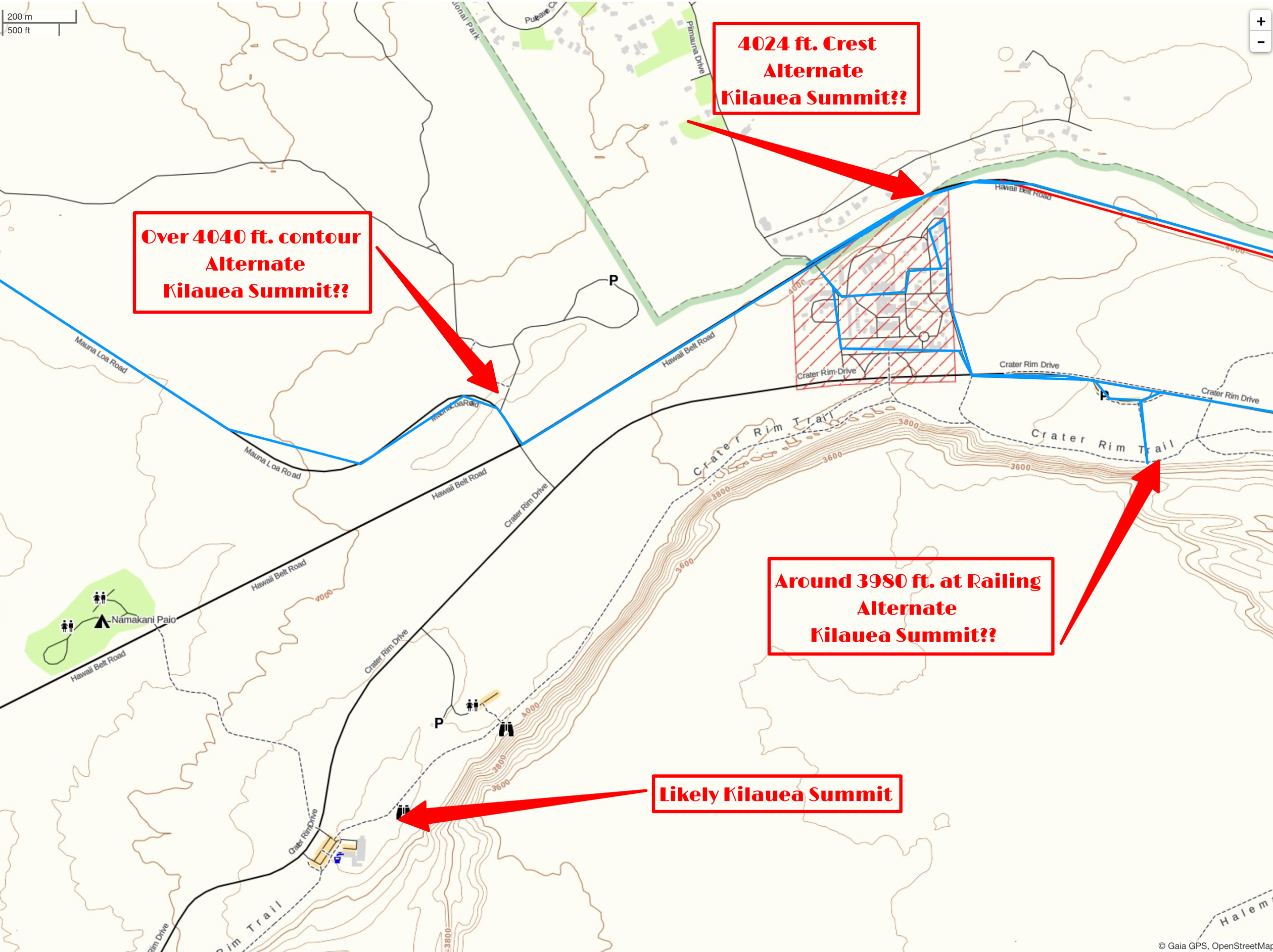
If you read the contour lines of USGS and the topo map below you can see the point near the Jaggar Museum is at least 4080 feet so the best bet is the summit is there. Also as I’ve spent some time now up on Mauna Loa and Hualalai and it seems summit points on these volcanoes tend to be right near the rims of their summit craters. Makes sense since when you think of the classic volcano, its summit would be its rim. It just gets a bit complicated when it appears much of the northern mass of Kilauea seems like it was formed by Mauna Loa flows.
Unfortunately, I can’t legally go to what is likely the actual summit near the Hawaiian Volcano Observatory (Jaggar Museum) since the area has been closed indefinitely by the Park Service. Yet I’ll wind up above and around it on this run so I guess it will have to be like horseshoes and hand grenades ;). And entertainingly that section might just collapse into Halema’uma’u one day – who knows.
But obviously, for this challenge of Sea to Summits, we need to define a point on Kilauea that is safe and legal to go to. Since I am the only one playing the game so far I’m going to propose either the “4024 Crest” sign or a 4040+ foot contour right on the Mauna Loa Road. What I like about the 4040 contour spot is that it is 1.6 miles from the 3980 ft railing location. This is the same distance it would be to the “True” summit along the Crater Rim Trail if it were open. So there is a nice logical consolation there for me. See map below for details.
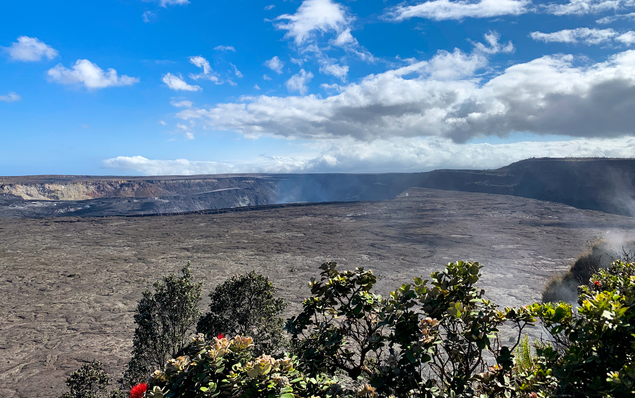
Ultimately, neither place is where I am going to make my offering. Kilauea is a live active volcano so really the only place to make a proper offering is to the Kilauea Summit Caldera. So I picked a nice place for that as well. And interestingly this could be the last possible choice for the summit. This has a satisfactory looking feel since you are in a beautiful completion point that allows you to look over and see the true summit. I’ll likely just run to all the locations just to cover my bases though.
And ultimately the big question: When I run from the bottom of the Chain of Craters road to the top of the Lookout on Sunday how do I get back to my truck 34 miles away?
Well, I got lucky with that one and a friend of mine in Volcano said she would pick me up at the lookout and drop me back off at the truck. How lucky is that?
Now all that is left to do is to go and run this section to feel it all out on my legs. Until then….
Related posts
-
-

Hamakua Challenge Training – Pololu to Honopue – Out and Back
August 20, 2019
-

Hamakua Challenge Training – Waipi’o to Waimanu – Out And Back
August 19, 2019
Leave a reply